Mohamed Hamoud
GIS & Engineering Digital Transformation Expert
GIS, IT, Digital Twin, Map, Geo, BIM, GISP, PMP, Spatial
I have more than 20 years of experience in various kinds of GIS (Geographic Information System) and Digital Transformation projects, with a focus on urban planning, construction, and survey domains. I have Master in IT and bachelor’s in Civil Engineering.
I am also certified as PMP (Project Management Professional), GISP (GIS Professional), CSQE (Certified Software Quality Engineer), CTT+ (Certified Technical Trainer) and MCP (Microsoft Certified Professional).
I worked for known organizations in United Arab Emirates including Dubai Municipality, Dubai Roads & Transport Authority (RTA), Ajman Municipality & Planning Department, and Abu Dhabi city Municipality.
My skills include business and system analysis, project management, quality improvement, strategic and operational planning, technical reporting, technical training, and public speaking.
49 years old
Driving License
Experiences
GIS Applications Developer
Dubai Municipality
September 2000
to July 2005

- Developed "CGIS" application which is used by the municipality's employees to browse and query the various available GIS layers in the municipality including land parcels, roads, addresses, buildings, POIs, aerial images, etc…
- Developed "Demarcation" application that is used by survey section to manage the land parcel demarcation process using GIS maps.
- Developed "QC" application which contains a workflow engine and used to register GIS and survey related requests and to follow-up the execution of tasks. The application has been later integrated with the interactive voice response (IVR) and the e-government portal.
- Participated in developing "DUGIS" web portal which was used to browse and query maps within the entire Dubai government entities using the governmental network.
- Developed other various desktop and WEB GIS applications using Visual Basic.NET, Visual Basic 6.0, ASP.NET, ASP 3.0, ESRI Map Objects, ESRI Arc Objects, ESRI ArcIMS, ESRI ArcGIS, and Intergraph Geomedia.
Education
Master in Information Technology (IT)
Preston University - UAE
2007
to 2009
B.Sc. in Civil Engineering
Damascus University - Syria
1993
to 1998
Skills
Project Management & Quality
-
Project Plans creation
Expert
-
Operational Plans creation
Expert
-
Report Writing
Expert
-
Presentation Skills
Expert
-
Work breaking down and scheduling
Expert
-
Processes Reengineering
Advanced
-
KPIs Defining
Advanced
-
S.M.A.R.T. goals setting
Advanced
Geospatial Applications Development
-
System Analysis
Expert
-
Database Modeling
Expert
-
Entire Software Development LifeCycle (SDLC)
Expert
-
Microsoft .Net
Expert
-
HTML 5 & Java Script
Advanced
GIS
-
ArcGIS Desktop
Expert
-
ArcGIS Enterprise & ArcGIS Online
Expert
-
ArcGIS Engine
Expert
-
ESRI Java Script API
Advanced
-
ArcGIS Pro
Advanced
-
QGIS
Intermediate
-
AutoCAD
Good
Professional Certificates
- PMP, Project Management Professional
- GISP, GIS Professional
- CTT+, Certified Technical Trainer
- CSQE, Certified Software Quality Engineer
- CQIA, Certified Quality Improvement Associate
- MCP, Microsoft Certified Professional
Interests
Interest
- Cinema
- Food
- Travel
- Cultures
Portfolios
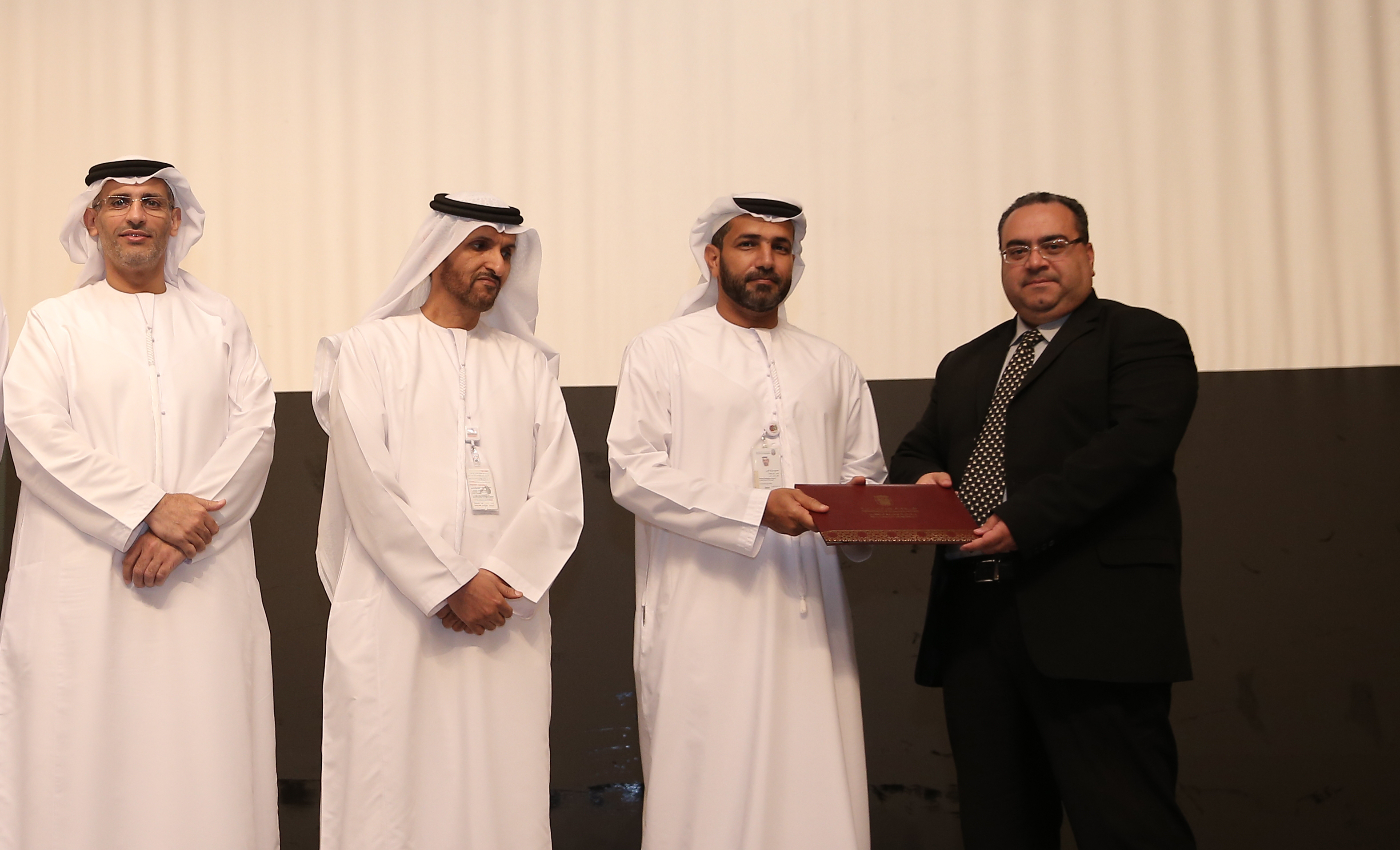
Receiving an excellence award from H.E. the general manager of Abu Dhabi City Municipality
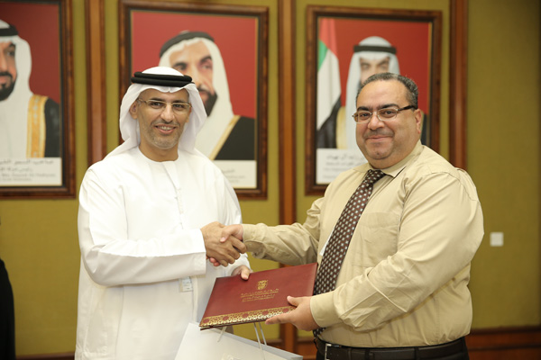
Receiving an appreciation certificate from H.E the executive director of town planning at Abu Dhabi City Municipality
Building's Data Management System
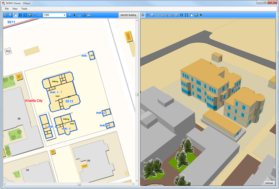
An in-house developed Geospatial system for creating a 2D/3D geodatabase for buildings including internal details, through a transactionl update process.
Takhteet (Planning)
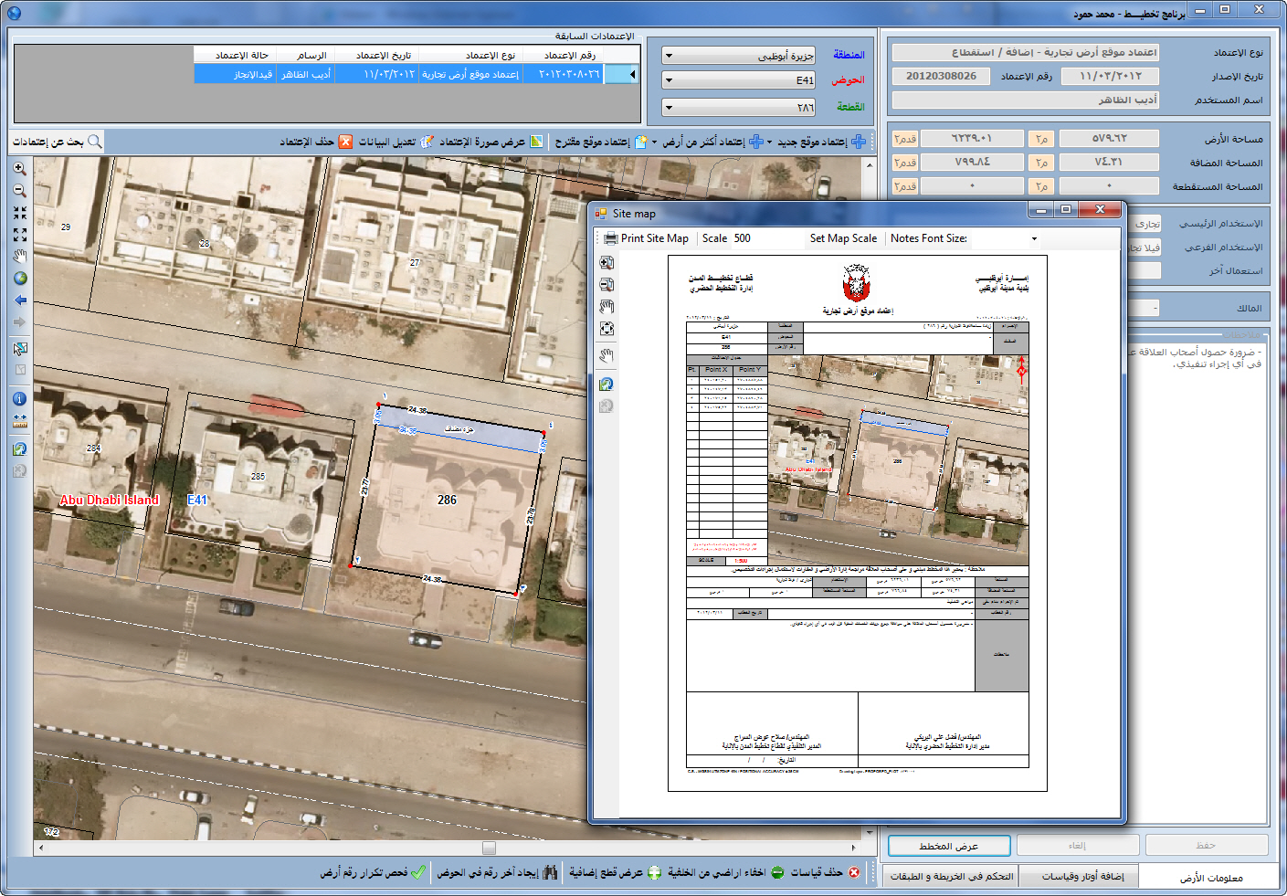
An in-house developed Geospatil system for automatically preparing and printing affection plans for land parcels.
Cemetery Management System
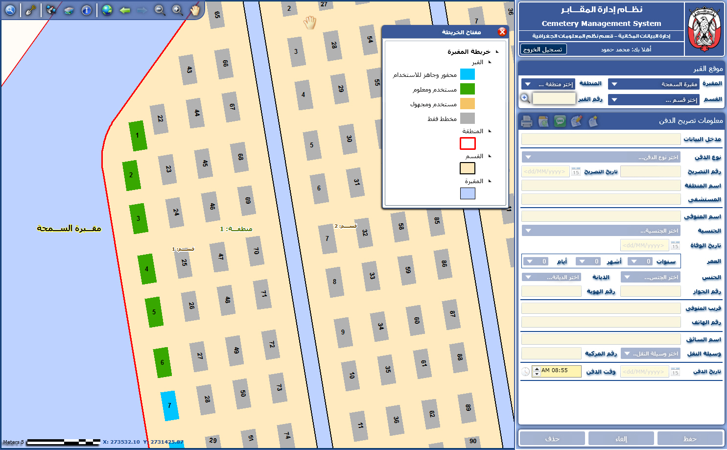
An in-house developed Geospatial system for managing cemeteries using maps.
ARDI (my land)
An in-house developed Geospatial application that runs on touch-enabled kiosk for querying land parcel's locations.
Creation date
01 Jan 2011

 Download